COMMUNITY WORKSHOP | Imbaba
Community Workshops
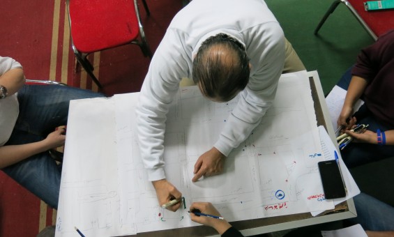
The purpose of the community workshops is to develop an understanding for different neighborhoods in Cairo from the perspective of those who know it the best: their residents. The community workshops start with a brief introduction of TADAMUN and a showcase of success stories of some local initiatives. The participants are then divided into small groups and are asked to draw a map of their area.
Approximately twenty residents participated in the ‘Izbit Awlād ‘Allam workshop and were divided into three groups; women, men and children. No instruction was given to influence the type of information or format used. The groups were then asked to comment on their own maps to highlight the following:
- The five best opportunities for improvement in the area
- The five biggest problems in the area
- The quality of services and facilities in the area
- The activities of local CSOs and NGOs in the area
Imbaba Community Workshop
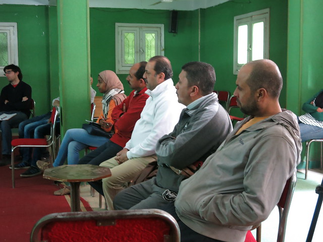
Engineer and urban researcher Amr Abu Tawilah organised the Imbaba workshop in collaboration with Takween Integrated Community Development Company. This workshop was held at the premises of the Urban Development Association in Imbaba and was attended by a number of the area’s residents.
Map Your Neighbourhood
The map drawing exercise clearly showed that the participants had a good understanding of their area. They covered all the major areas of Imbaba and added a great deal of detail to their maps. It was noticeable that all the maps produced by the participating groups were largely consistent with one another in terms of the identified boundaries of Imbaba. Both groups identified Sudan Street, the Nile Corniche and the Ring Road as the outer perimeters of their area. There were also no differences in terms of the explanations of the major landmarks inside Imbaba. The following major squares and roads were commonly identified: Kit-Kat square, Trolli square and Wehda, Orouba and Qawmiya Streets. According to the participants’ maps, Imbaba is subdivided into a number of areas: Ard Aziz Ezzat, Bashteel, El Mounira El Sharqiya, El Mounira El Gharbeiya, Madinet El Ommal, Madinet El Tahrir, Ard El Gameiya, Ard El Haddad, and Madinet El Sadat.
The participants also identified the most significant features and the locations of the public utilities available in Imbaba. Among the landmarks identified were the Amiryia Printing Press and the well-known Prince restaurant. With respect to the public facilities, the participants identified a number of schools, hospitals, police stations and the youth centre. According to the maps, there are a number of schools in Ard El Gameiya and two hospitals – the fever hospital and the central hospital on El Wehda Street next to the Corniche. In addition, the maps also identified the location of the fruit and vegetable market in El Mounira El Sharqiya. The participants were also keen on showing on the maps the places they themselves frequented such as the Hekayia and Hadouta Coffee shop on El Gaysh Street and Wimpy on El Wehda Street.
The Best and Worst Places in the Neighborhood
All the participants in the workshop unanimously agreed that Madinet El Ommal, Madinet El Tahrir, Ard El Gameiya and Madinet El Sadat were among the best areas in Imbaba because they were well planned. But these areas have drastically changed since their construction. For example, the streets of Ard El Gameiya are now overcrowded and the gardens that once surrounded the houses in Madinet El Ommal have all disappeared. However despite these changes, these areas remain, in the view of the participants, the best areas in Imbaba. Some participants added Ard El Haddad to this list as it was their personal opinion that the residents in this area were well-educated and the area was well planned, although this was not a view shared by all the participants. Others included the wedding halls on the Corniche on their list because they served the entire area.
When identifying the worst areas, opinions did not vary much as there was consensus that El Basrawy was the worst area in Imbaba. The participants described El Basrawy as a predominantly informal area where crime and drug use are widespread. The participants’ lists enumerated a number of other unsatisfactory areas which included Bashteel where there are heaps of garbage, “which would take the armed forces a year to clear up” as one participant stated, and Ard Aziz where the residents live “underground”. The participants also mentioned the overcrowded Ezbet El Sa’ayda and the main Qawmiya thoroughfare which has been taken over by itinerant street vendors.
Distinguishing Features and Problems of the Neighborhood
When the participants were asked about Imbaba’s distinguishing features, one of the participants commented that “it has none”. However, in spite of this comment and their initial tentativeness, the participants did identify some positive features in their area. According to many of the participants, the positive features of the area are found in the the social relationships that residents enjoy as well as the vitality of the area – as demonstrated by one participant’s description that “the area never sleeps”. Moreover, the participants praised Imbaba’s excellent location with its easy access to a number of other districts in the city. Others highlighted the historic battle of Imbaba and the enduring institutions such as the Amiriya Printing Press and the grain silos to demonstrate the historic importance of the area. Others still pointed out that their daily requirements were easily obtainable which eased their daily lives and finally others felt that the proliferation of non-governmental organisations in Imbaba was one of its positive features.
Problems were numerous and were easily identified by all participants in comparison with the positive features of the area. Discussions revealed that garbage collection and sanitation were the two most important problems facing the area’s residents. The presence of garbage scattered throughout the area (as a result of government neglect, as well as the behaviours of residents) results in the spreading of diseases and infections. The dilapidated sanitation networks cause problems in some areas of Imbaba such as Ard Aziz Ezzat. In addition to these two problems, the residents complained about public transport and health services. Public transport does not serve the area at all and the residents are forced to use microbuses and motorised rickshaws – i.e. private transport – to travel within the area. The participants enumerated a number of problems relating to these means of transport such as the cost of transport and the fact that many of the drivers do not hold driving licenses. With regards to health services, the participants complained about the inadequate number of hospitals and the poor quality of the services that are provided. This forces the residents to turn to private hospitals and charitable clinics. The problems experienced by the participants were not limited to the above mentioned problems. Some participants also identified the lack of sufficient schools, the death of green spaces, and the prevalence of crimes and violence as additional problems which plague the area. Imbaba does have many schools, but according to the estimates of one of the participants they remain inadequate in serving the growing demands of the local population. As for green spaces, Imbaba is completely devoid of them. A new park was opened on the Imbaba Airport land recently, but the entry fee was prohibitively expensive for the residents and none of the participants had visited the park since it was opened in July 2014.
If I were Head of the District, I would…
At the conclusion of the workshop, participants were asked what would be on their agenda if they were district heads. Participants contributed the following answers as solutions to the area’s problems:
- Introduce a system to solve the garbage problem.
- Launch awareness-raising campaigns about the importance of cleanliness.
- Clear the streets of itinerant street vendors.
- Replace all employees working in the local district with a team of youth.
- Organize traffic in the area.
- Collect fees from the numerous shops on El Qawmiya street to pay for traffic officers.
- Remodel the area to make it more attractive.
- Create an integrated transport network which would include the private transport currently serving the area as well as public transport.
- Provide work opportunities for the younger generation.
- Repair the sanitation network.
- Improve health services.
- Identify solutions to the problems of the gas supply.


Comments